Map Data for Yellowstone National Park
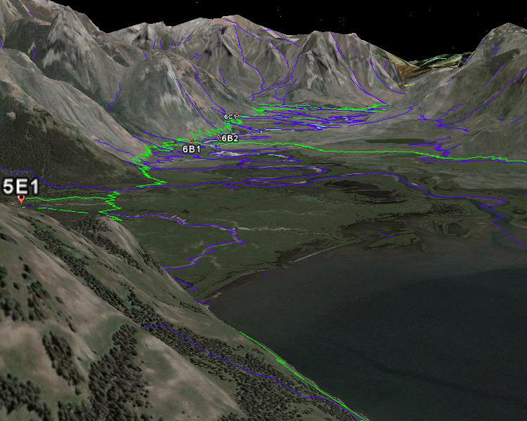
We have converted public domain spatial data into formats that can be either uploaded to your gps unit or pasted into Google Earth. Download the files below and make 3D maps like the one shown here, or carry new waypoints with you on your next Yellowstone hike.

Above: A Three dimensional map of Yellowstone's Thorofare region that was produced with Google Earth and public domain data layers. Green lines are trails. Blue lines are Rivers and Creeks. Labeled points are backcountry campsites.
Instructions:
The files listed below can be dropped directly into your Google Earth browser. Polygons (such as the one that depicts Yellowstone's boundary) should be modified to display as an "outline" rather than "filled." You can do this by right-clicking on the file's name in the "my places" window of Google Earth's side bar. Several of the layers have fields that can be set to display with a unique color for each value. For example, you can display each of the 1988 fires in a different color.
The gps (waypoint) files on this page have been formatted for a Magellan Explorist 400 GPS unit. They can be easily converted to other GPS formats using GPSBabel, which is available as a free download here.
Files available for Download:
If you are using Windows, right-click on the links below and select "Save As." Save the file to your hard drive and then drop it into Google Earth or upload it to your GPS unit. If you merely click (left click) on the links below, then you will see the raw text data in your browser.
Boundaries
Yellowstone's Boundary: Google Earth Format
Boundary of Yellowstone's "Northern Range:" Google Earth Format
Greater Yellowstone National Forest Boundaries: Google Earth Format
Yellowstone's Major Lakes: Google Earth Format
Human-made features
Yellowstone's backcountry Campsites: Google Earth Format GPS Waypoints
Yellowstone's backcountry patrol cabins: Google Earth Format GPS Waypoints
Yellowsone's Trails: Google Earth Format (4 megabytes)
Yellowstone's Roads: Google Earth Format
Historic Mine Sites: Google Earth Format GPS Waypoints
Stream Gages: Google Earth Format GPS Waypoints
Natural Features
1988 Fire Boundaries: Google Earth Format (2 megabytes)
YNP Snow Depth Zones: Google Earth Format
Yellowstone's Rivers and Creeks: Google Earth Format (10 megabytes)
Yellowstone's Geothermally Active Areas: Google Earth Format
If you find that these data layers are useful to you, then return the favor by sharing your own data with us. We'll post them here on this page. Send questions or data to information {at} yellowstoneecology {dot} com.

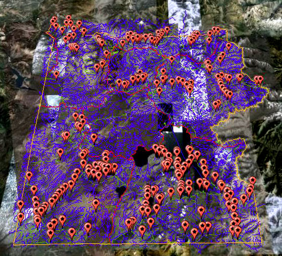
Above: Google Earth map of Yellowstone National Park, showing all backcountry campsites, roads, streams, and trails.
